How Directional Drilling Works in Monroe Ground
Two banks, two Louisianas
The river splits the region's geology as cleanly as its street grid: west of the Ouachita, the piney uplands — silts, sands, and loams with genuine relief, well-drained hill-country drilling that runs cooperative and fast; east of it, the Delta — the Mississippi valley's flat backlands, heavy clays and saturated silts where the wet-ground program is the default: engineered dewatered pits, ballast on the pull, and fluid discipline in ground that holds water like the farmland it feeds. Bank-to-bank quoting names the side, prices the programs separately, and treats the river as the estimating line it genuinely is.
The two inheritances: fiber and the field
Monroe's history left the trade two local endowments. The telecom inheritance: a hometown company grown to national scale seeded the region with routes, splice-literate institutions, and a workforce that reads conduit drawings natively — fiber work here meets informed customers. The gas-field inheritance: one of America's storied early fields spreads beneath the north and east, and its working legacy — old wells, gathering corridors, layered easements — makes records research and locate discipline genuine craft. The first raises the bar; the second rewards the diligent; our quotes honor both.
The sequence, river-parish edition
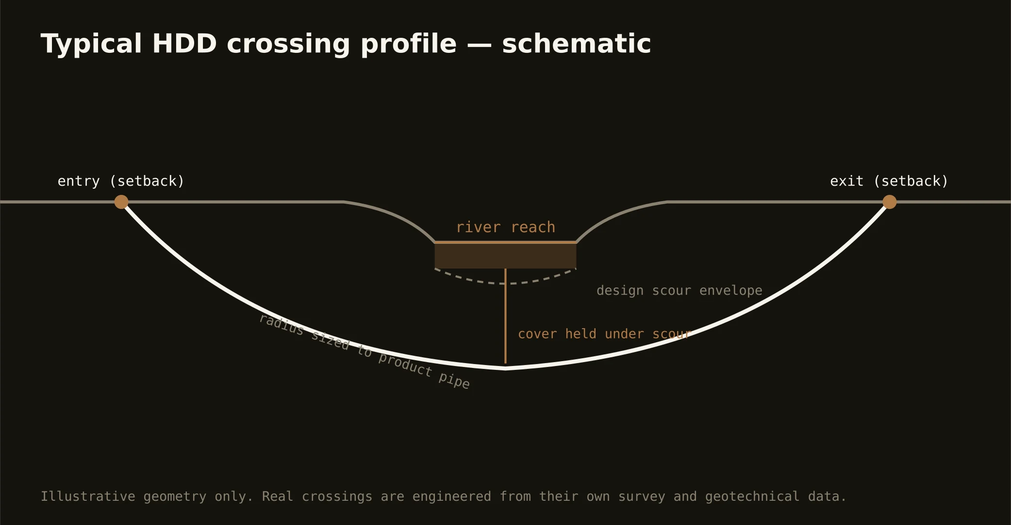
The bones are standard — locates plus private designating, potholes on every claimed utility, pilot on profile, ream to about one and a half times the product, pull, restore. River-parish bends: programs assigned by bank, the ledger check in the field's belts, stage-aware staging near the levees, Sparta-grade fluid stewardship over the aquifer, drainage-district criteria on the backland channels, and restoration that treats piney-hill ROW, Delta headlands, and twin-city streets as the different surfaces they are.
Who owns what you're crossing
The cities run their own ROW counters; three parish public-works departments cover the roads between; DOTD permits I-20 and the state spines. The Ouachita brings federal navigation review and the levee district; DeSiard brings the water utility's source interests; the drainage machinery governs the backland channels; railroads permit the mill-and-port serve; and the gas field's operators keep their corridors. The quote names every owner on your alignment — here, the first question is which bank, and the second is what history runs beneath it.
Straight answers
Will you hit rock on my bore?
No — neither bank stocks rock at utility depth: the uplands run silts and sands, the Delta runs clays and saturated ground, and the honest cautions are water and history rather than stone. The quote prices your bank's real conditions and runs the ledger check where the old field says to.
How deep do bores run under Monroe streets?
Cover follows the owning authority's standard and sits below everything potholed on the alignment — with river and levee-adjacent crossings running to the district's and federal criteria, which govern absolutely. The bore plan states your number and your bank before mobilization.
Is the Sparta aquifer a constraint on drilling?
It's a responsibility more than a constraint: the region guards its aquifer with justified seriousness, so clean-fluid practice, containment, and proper disposal run standard on every bore over it — which is to say, on most of them. It costs discipline rather than schedule, and our quotes carry it as the local baseline it is.
Ready to put a number on a real crossing? Send the scope — a person prices it.